ADS-B Radar
Track & Spot Aircraft - with notifications!
What is ADS-B Radar?
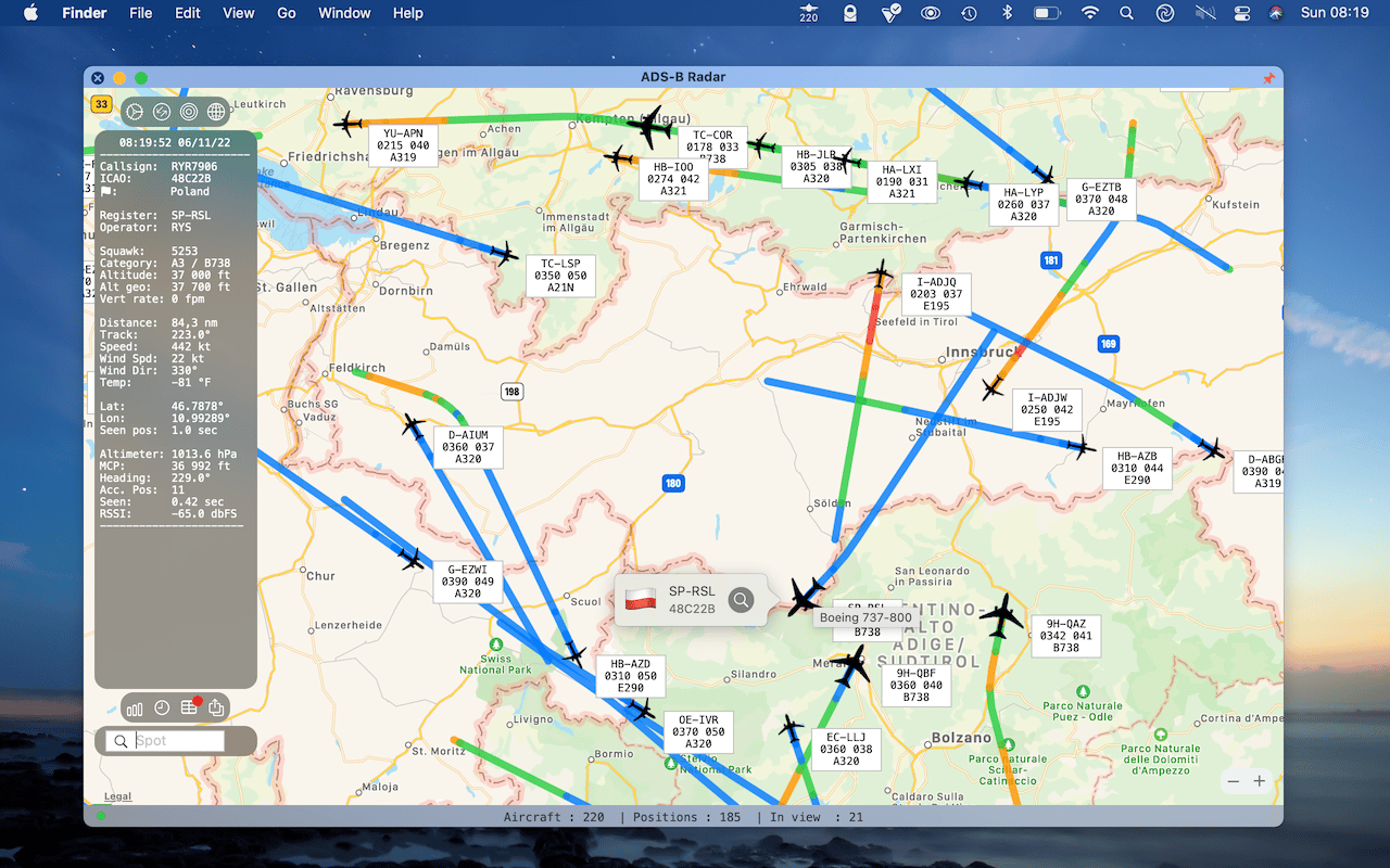
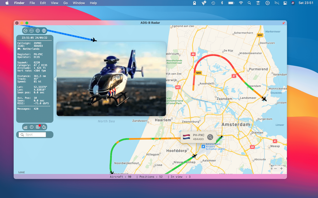
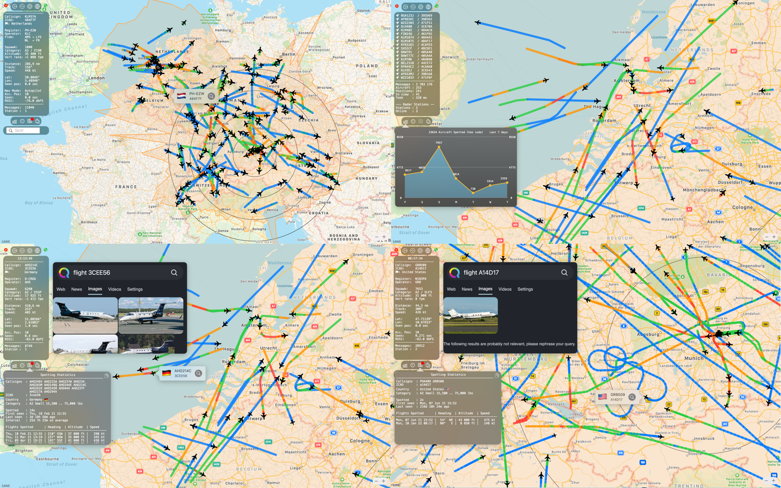
An aircraft tracking & spotting app that lives on the macOS status bar. At a glance you know how many aircraft are currently in range of your ADS-B radio receiver. Click the icon to open a map showing the position of the aircraft, the route and all ADS-B flight statistics. The map is continuously refreshed and aircraft move “live” to their new position. The route is visible on the map, blue represents level flight, while green, orange and red represent an increasing/decreasing vertical rate of speed.


How to get started / what are the requirements?
- You need a hardware ADS-B receiver running dump1090 or the Jetvision RadarCape/Air!Squitter receiver
- Before purchasing the App, check if you have access to your json file and you can view it in Safari:
- Enter the URL of the ‘aircraft.json’ file from dump1090 or the ‘aircraftlist.json’ file from the RadarCape/Air!Squitter receiver. Examples:
- http(s)://receiver-ip/dump1090/data/aircraft.json
- http(s)://receiver-ip/dump1090-fa/data/aircraft.json
- http(s)://radarcape/aircraftlist.json
- Use a test URL to view data from RadarCape: https://radarcape-demo.jetvision.de/aircraftlist.json
- Create a symbolic link (FlightAware) to http(s)://receiver-ip/data/aircraft.json
-
cd /var/www/htmlsudo ln -s /run/dump1090-fa datacd /var/www/html sudo ln -s /run/dump1090-fa data
cd /var/www/html
sudo ln -s /run/dump1090-fa data
- Before purchasing the App, check if you have access to your json file and you can view it in Safari:
- Open the ADS-B Radar App (click the icon on the menu bar)
- Click the cog wheel (top left icon)
- Enter the URL to the ‘aircraft.json’ file from dump1090 or the ‘aircraftlist.json’ file from the RadarCape/Air!Squitter receiver.
- Enter the lat/lon and range of your receiver

What makes it different?
- Beautiful and crisp graphics and text
- Low CPU and energy consumption
- ATC style info box next to the aircraft
- Menu bar icon with number of aircraft in range
- Local Notifications with re-post possibility
- Search option & Fullscreen option
- Independent from online databases, completely private
- Log aircraft to a local SQLite database for historic flight info
- Uses Apple Maps – fast, reliable, private
- Built-in web browser for online aircraft search
- Be independent and own your data, no need to feed FlightAware, Flightradar24, etc.
- Enable search for aircraft details and photo on the public adsbdb.com API.
- Build your own ADS-B network by adding more stations
Notifications
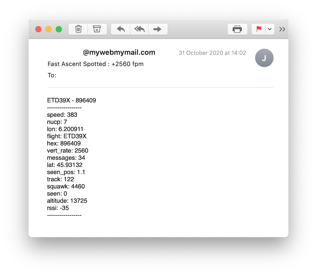
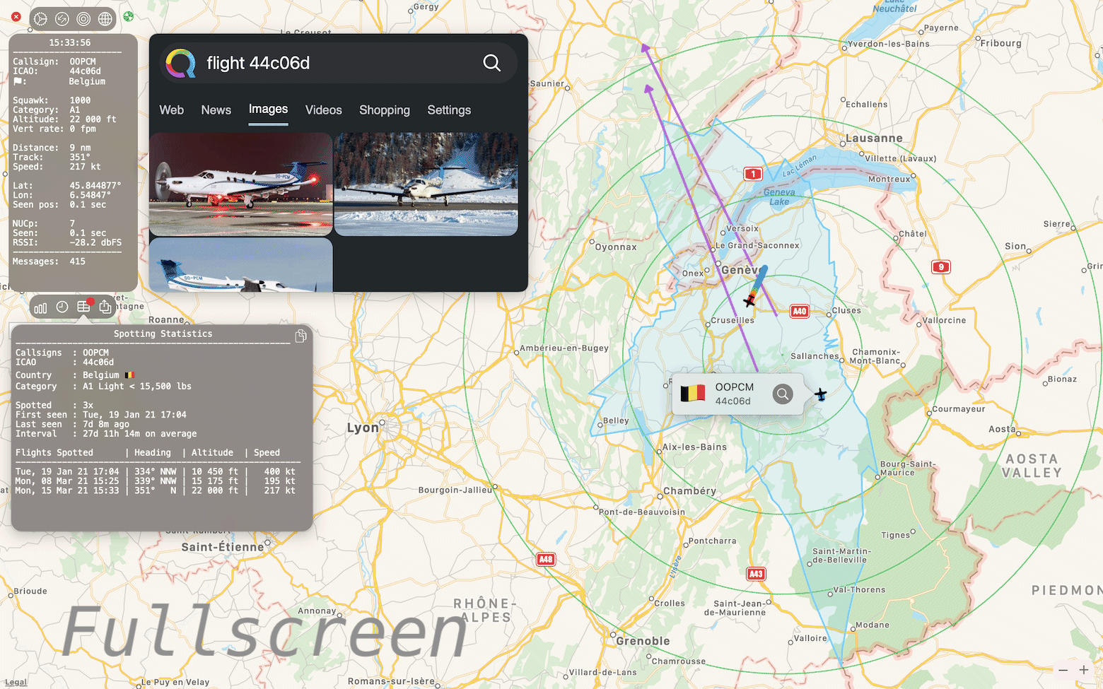
When you’re not using the app, it monitors the air traffic in the background and is able to notify you if it spots specific callsigns, icao codes, countries or squawks. A wildcard ? suffix/prefix will monitor for a partial match on icao, callsign or aircraft type. It will also spot high or low altitudes, vertical rates, speeds, the distance to your receiver and the number of aircraft within reception range. A local macOS notification will be shown (see below). If you have the map open, the notification will be displayed on the map.


Re-post Notifications
It is possible to re-post the notifications and aircraft information in JSON to a web server for further processing. For example you might want to receive an email, tweet, auto post to a blog or log interesting data to a database. Further details on the ADS-B Radar JSON format are available here.
Map Options

Map Behaviour
Depending on your preferences you can show an ATC box (Air Traffic Control) next to each airplane. The ATC box will change color based on the height of the aircraft and shows altitude, speed, aircraft type and callsign. Disable this option to show only the aircraft icon. Alternatively let aircraft animate to their new positions.
Polar Plot
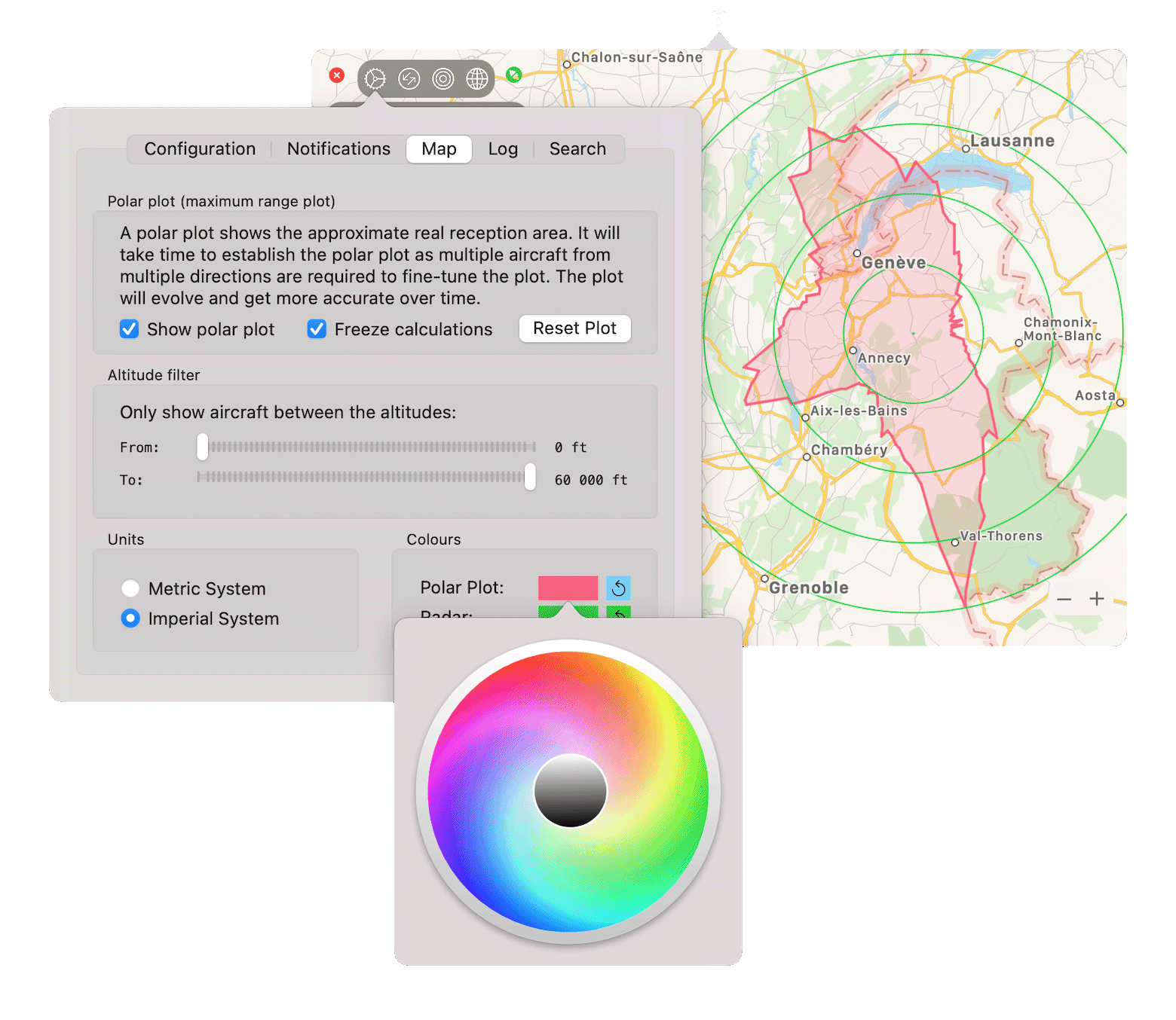
The polar plot option will determine the exact reception range of the receiver, it will get more accurate over time as multiple aircraft from multiple directions are required to fine-tune the plot. The color of the plot itself, as well as the colour of the radar rings are user configurable. Once the polar plot has been determined to a satisfactory accuracy, you are able to ‘freeze’ the calculations.
Altitude Filter
If you’re only interested in aircraft within a certain altitude band, enable the altitude filter. This could be useful to reduce the amount of aircraft displayed on the map, look for small planes, or high flying private or commercial aircraft.
Log to a local SQL database
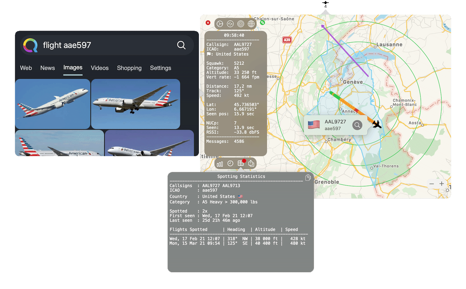
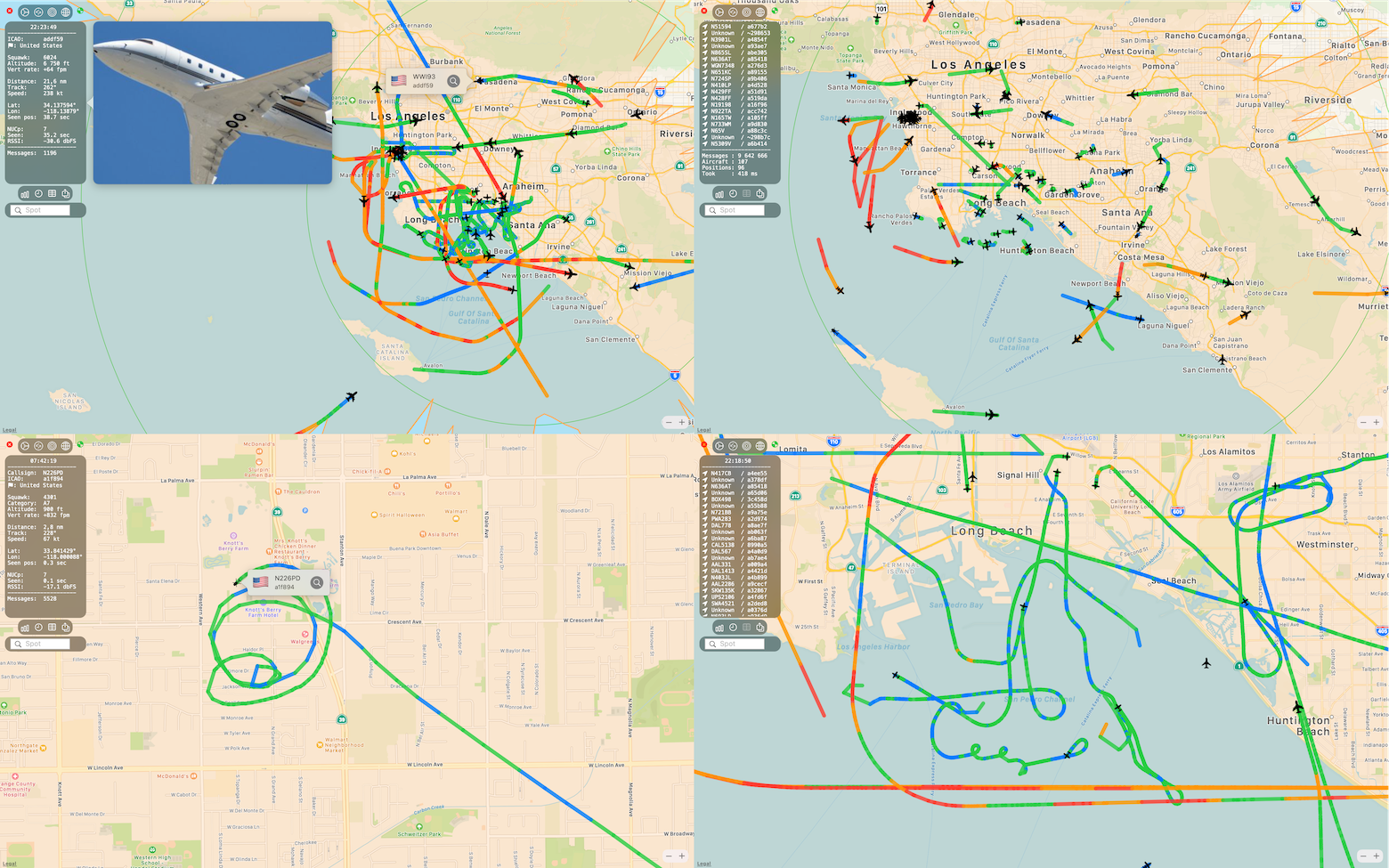
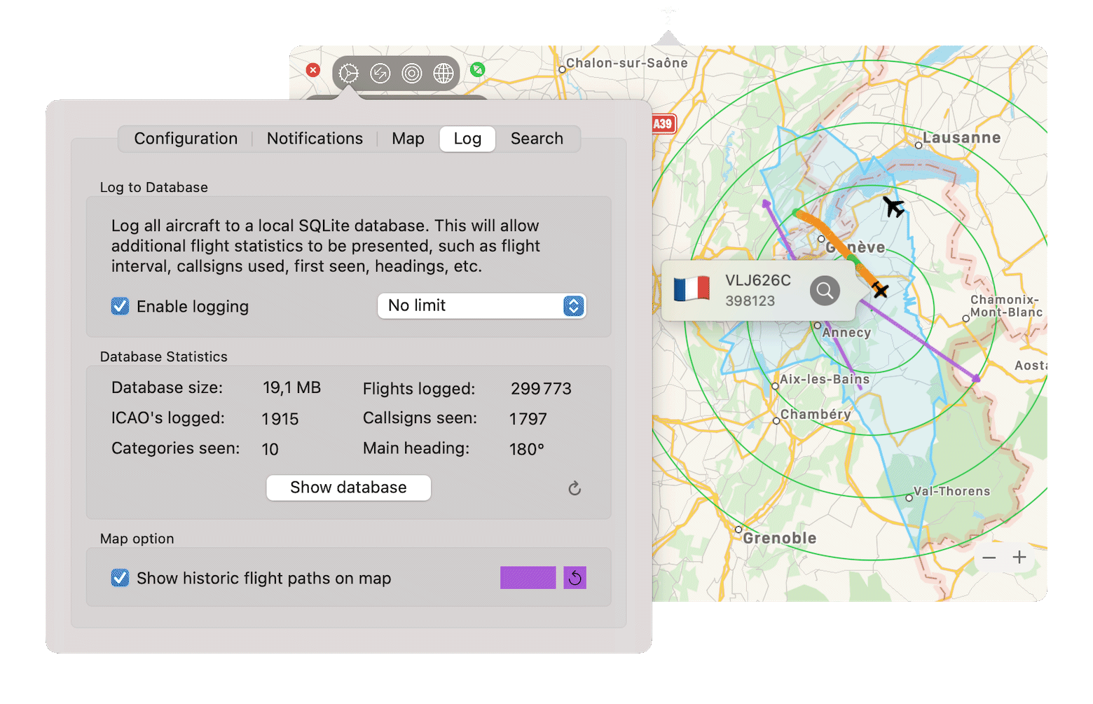
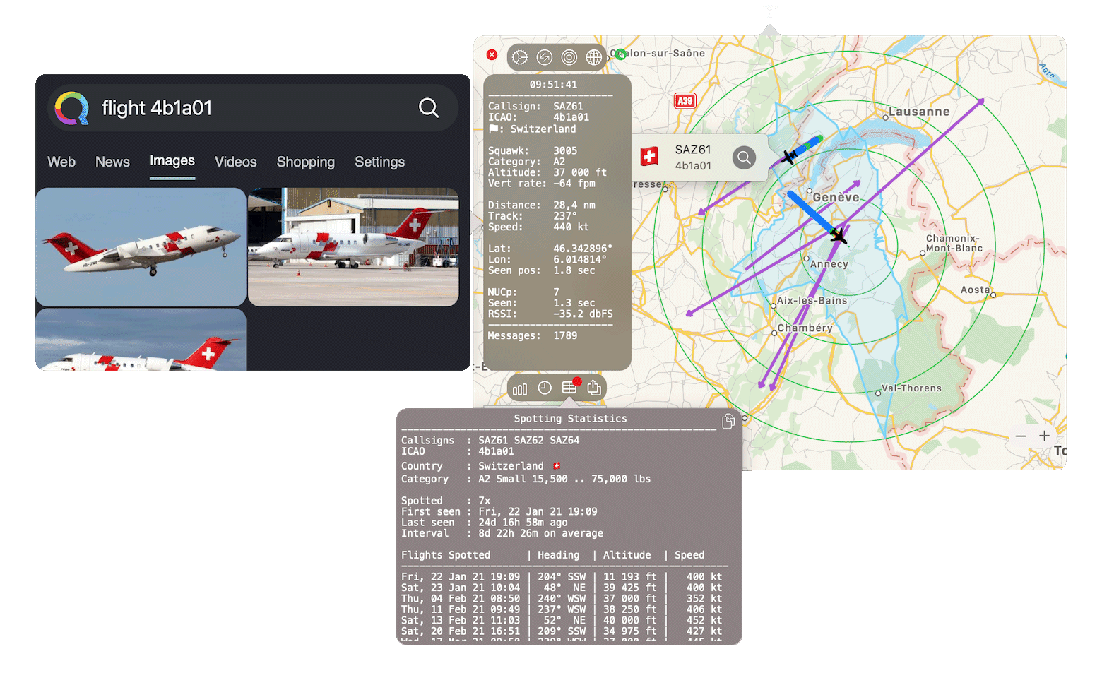
Log all raw data from the aircraft to a local SQLite database to provide a detailed history on flights, callsigns, altitudes, headings and speeds. Plot old flight paths on the map for a better understanding of typical flight patterns. The color of the flightpaths is user configurable. The SQLite database is readable so you can run your own analysis and statistics as well.

Search the internet
There are two options to retrieve more information on an aircraft, without search enabled, you can click any aircraft and the callsign and ICAO code will be copied to the pasteboard so you can launch a manual search. Optionally enable the built-in mini browser for a quick search on the hex/icao code with your preferred search website.
The search URL for the mini-browser is user configurable so you can point to your own source or search engine, the hex/icao code will be pasted at the end of the URL, some examples:
- https://www.planespotters.net/search?q=
- https://opensky-network.org/aircraft-profile?icao24=
- https://whatisflying.com/en/database/aircraft/
- https://lite.qwant.com/?t=images&theme=1&q=flight%20
- etc.

Enable the option adsbdb.com to search for more detailed data and photos on the public API from adsbdb.com. This option will also enable the possibility (when the info is available) to plot the route between the departure and destination airport.
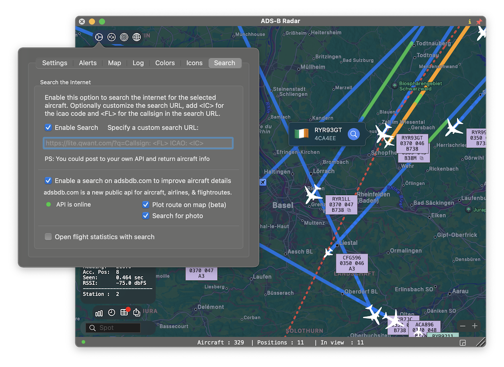

Click the “zoom to route” button on the bottom right of the window to show the complete route of the aircraft.

Multiple ADS-B stations
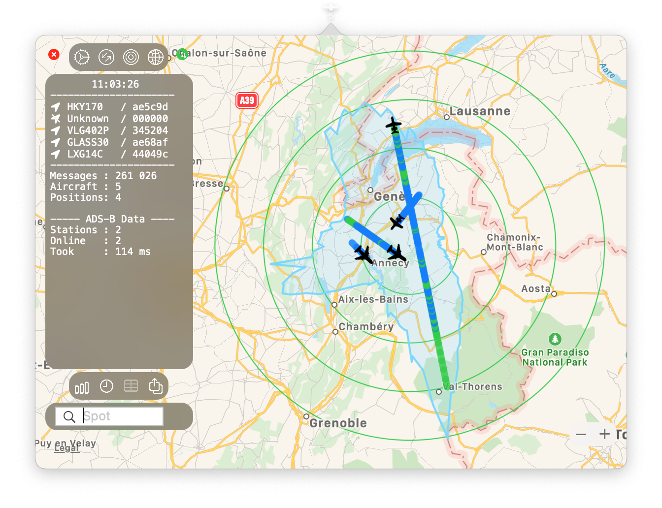
Expand your radar range by adding data from multiple ADS-B radar stations. Add the aircraft.json URL’s from the other stations to the configuration and ensure they slightly overlap to maintain a true polar plot.
Colors
Nearly all colors used on the map are user configurable.

All options:
- User configurable URL to the aircraft.json file (add multiple stations in a comma separated format)
- Lat, Lon and range of the receiver (for radar rings, distance, polar plot calculations)
- Map refresh rate (animation & polling interval)
- App background refresh rate (polling interval when not in use, to update the icon)
- Hide stationary aircraft after user selectable period
- User configurable URL to the JSON notification re-post (i.e. to a PHP file on a webserver)
- Over 13 user configurable notification options, some with multiple entry
- Polar plot option with possibility to freeze calculations when plot is ready
- Aircraft altitude filter to only show aircraft between certain altitudes
- Metric & Imperial units
- User selectable color for polar plot and radar rings
- Last 7-day activity graph (works without database logging)
- Share button to share a snapshot of the radar view with aircraft & flight data
- Search bar to find aircraft on the map easily
- Option to show all flight tracks simultaneously, or only for the aircraft selected
- Option to switch radar rings on or off (also used to zoom in on the receiver location)
- Option to show ATC style info box with callsign, altitude, speed and category/type next to each aircraft
- Apple Map options: Standard, Satellite, Hybrid
- Log data to a local SQLite database for additional statistics
- With logging enabled, plot historic flight paths on the map
- With logging enables, show all aircraft logs and info from the last 24hrs
- With logging enabled, show all specific aircraft info such as last seen, calls signs used, flight interval
- Enable a popup mini-browser for an internet aircraft search with user configurable URL
ADS-B Radar requires hardware!
Privacy
This app does not rely on a built-in or online database with aircraft information, it works completely autonomous and is therefore very private. In turn, it will not display information such as airport of departure, destination, aircraft type, etc. Simply click the copy button next to the aircraft on the map, and search the internet manually by callsign and/or ICAO code. Or better – enable the built-in mini browser for a quick and easy internet search, with the search engine of your choice, without leaving the App. If you prefer to have details on the aircraft, enable the adsbdb.com public API under search settings in the App. It requires no sign-up and you will receive additional information such as aircraft type, origin and destination.
Screenshots

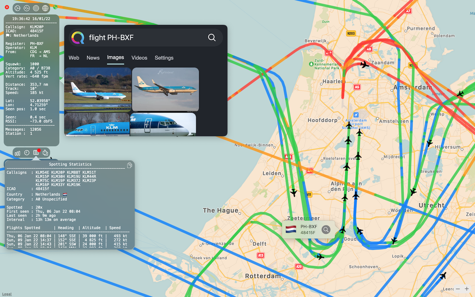
ADS-B Radar is completely ad free, in-app purchase free, subscription free, private, safe, requires no sign-up and no API registration.
